


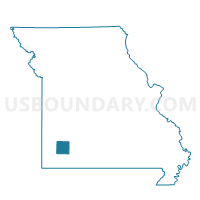
Green Voting District, Lawrence County, Missouri
About
Outline

Summary
| Unique Area Identifier | 608936 |
| Name | Green Voting District |
| County | Lawrence County |
| State | Missouri |
| Area (square miles) | 42.14 |
| Land Area (square miles) | 42.07 |
| Water Area (square miles) | 0.08 |
| % of Land Area | 99.81 |
| % of Water Area | 0.19 |
| Latitude of the Internal Point | 37.22671310 |
| Longtitude of the Internal Point | -93.91478150 |
Maps


Graphs
Select a template below for downloading or customizing gragh for Green Voting District, Lawrence County, Missouri


Neighbors
Neighoring Voting District (by Name) Neighboring Voting District on the Map
- Grant & Smith R-1/East Lockwood/E. Ward City Voting District, Dade County, MO
- Lincoln Voting District, Lawrence County, MO
- Mt. Vernon North Voting District, Lawrence County, MO
- Red Oak Voting District, Lawrence County, MO
- South & Smith R-4/Washington/West Center/S. Ward City/S. Sac Voting District, Dade County, MO
- Vineyard Voting District, Lawrence County, MO
Top 10 Neighboring County Subdivision (by Population) Neighboring County Subdivision on the Map
- Mount Vernon township, Lawrence County, MO (7,560)
- Lincoln township, Lawrence County, MO (1,664)
- Vineyard township, Lawrence County, MO (1,048)
- Green township, Lawrence County, MO (442)
- Red Oak township, Lawrence County, MO (410)
- Smith township, Dade County, MO (196)
Top 10 Neighboring Unified School District (by Population) Neighboring Unified School District on the Map
- Mount Vernon R-V School District, MO (9,214)
- Miller R-II School District, MO (4,104)
- Greenfield R-IV School District, MO (3,250)
- Lockwood R-I School District, MO (2,303)
Top 10 Neighboring State Legislative District Lower Chamber (by Population) Neighboring State Legislative District Lower Chamber on the Map
Top 10 Neighboring State Legislative District Upper Chamber (by Population) Neighboring State Legislative District Upper Chamber on the Map
Top 10 Neighboring 111th Congressional District (by Population) Neighboring 111th Congressional District on the Map
Top 10 Neighboring Census Tract (by Population) Neighboring Census Tract on the Map
- Census Tract 4702, Lawrence County, MO (7,783)
- Census Tract 4703, Lawrence County, MO (5,445)
- Census Tract 4701, Lawrence County, MO (4,162)
- Census Tract 4802, Dade County, MO (3,147)